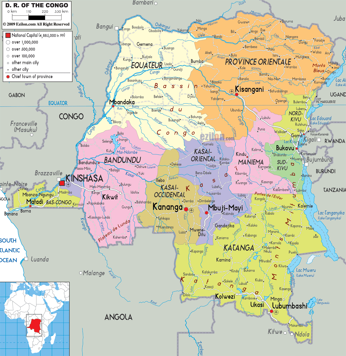
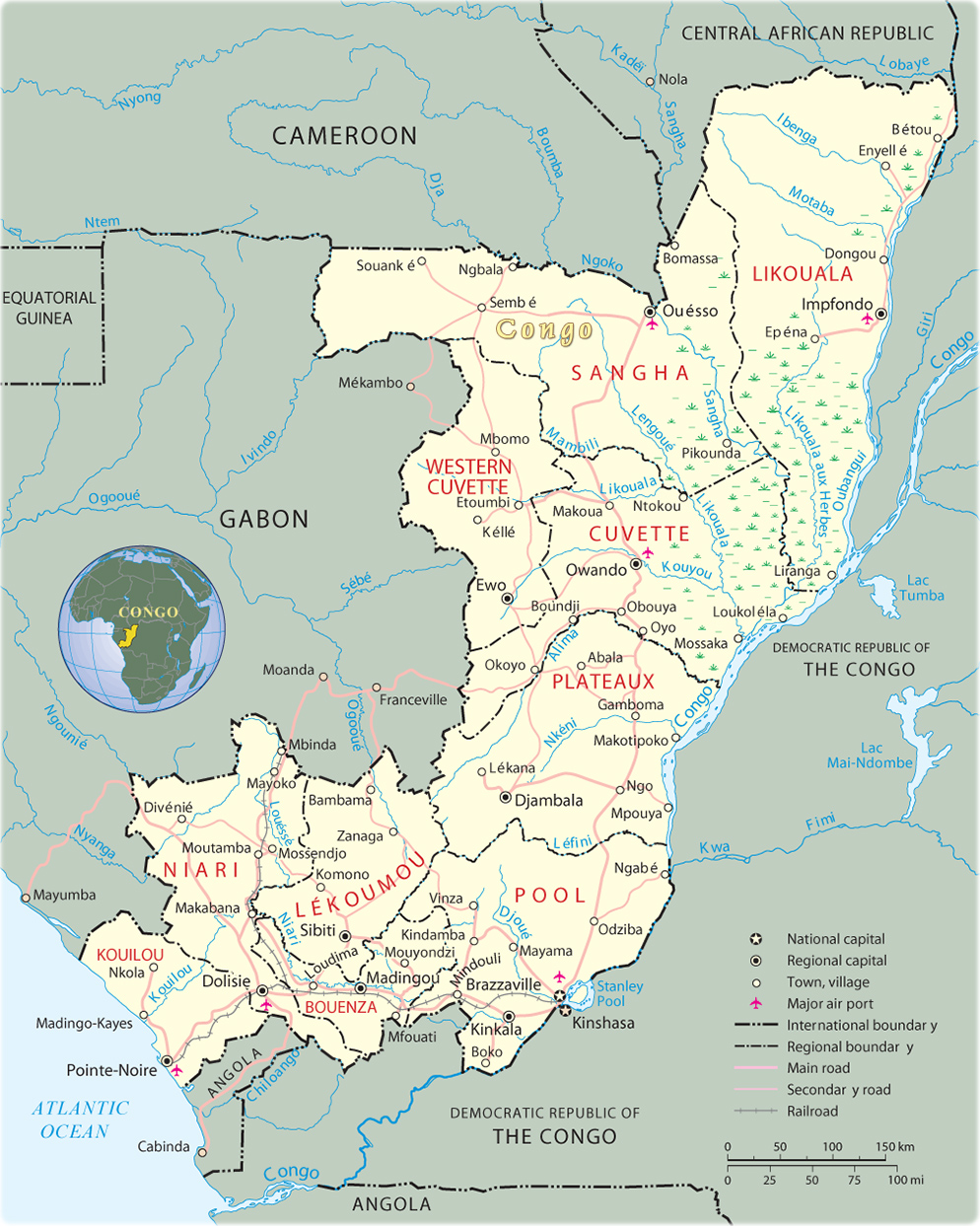
Administrative Map of Republic of the Congo
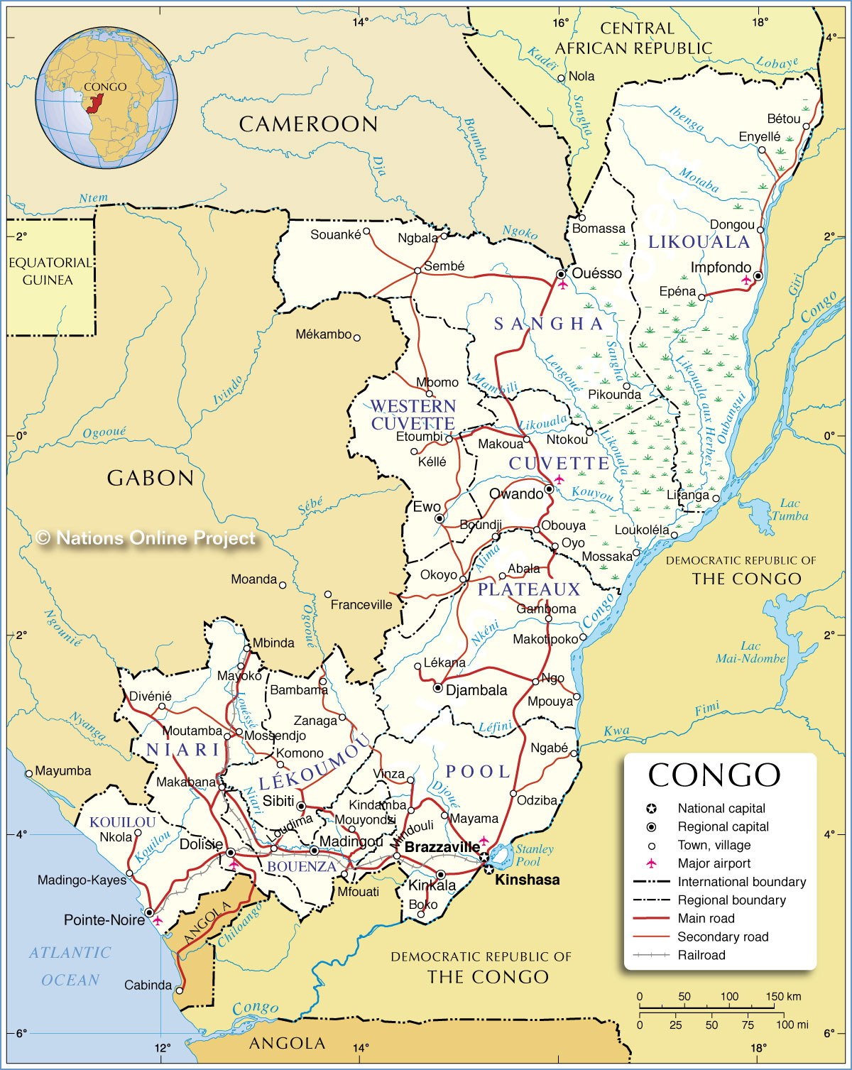
The Republic of the Congo (French: République
du Congo), also known as Congo, Congo Republic,[5] West Congo, or
Congo-Brazzaville, is a country located in Central Africa. It is bordered by
five countries: Gabon to the west; Cameroon to the northwest; the Central
African Republic to the northeast; the Democratic Republic of the Congo to the
east and south; and the Angolan exclave of Cabinda to the southwest.
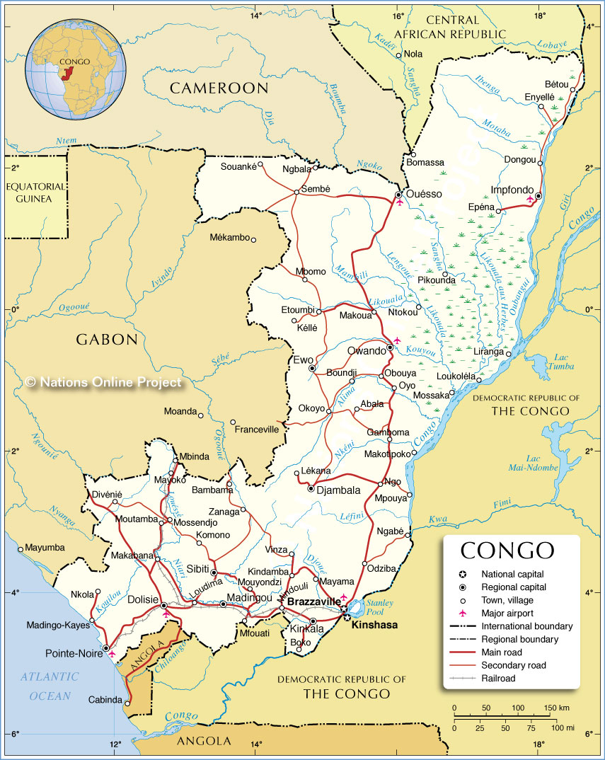
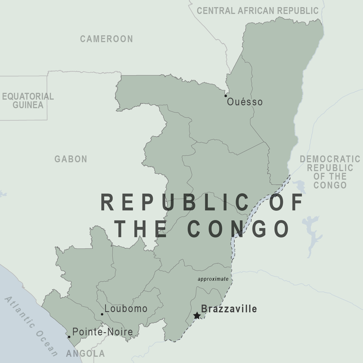
Political Map of Republic of the Congo
The region was dominated by Bantu-speaking tribes, who built trade links leading into the Congo River basin. Congo-Brazzaville was formerly part of the French colony of Equatorial Africa.[1] Upon independence in 1960, the former colony of French Congo became the Republic of the Congo. The People's Republic of the Congo was a Marxist–Leninist one-party state from 1970 to 1991. Multi-party elections have been held since 1992, although a democratically elected government was ousted in the 1997 Republic of the Congo Civil War and President Denis Sassou Nguesso has ruled for 26 of the past 36 years.
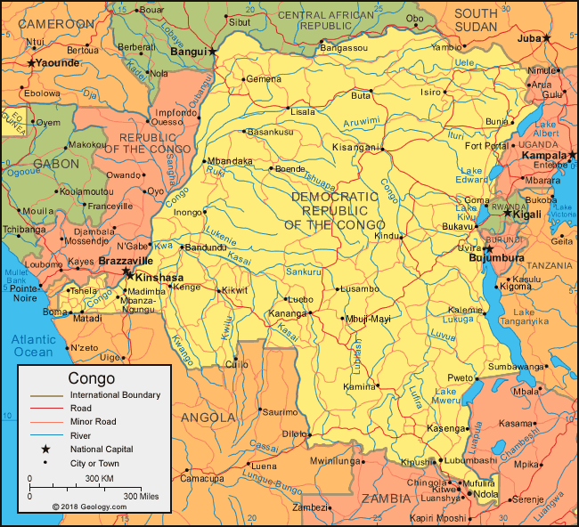
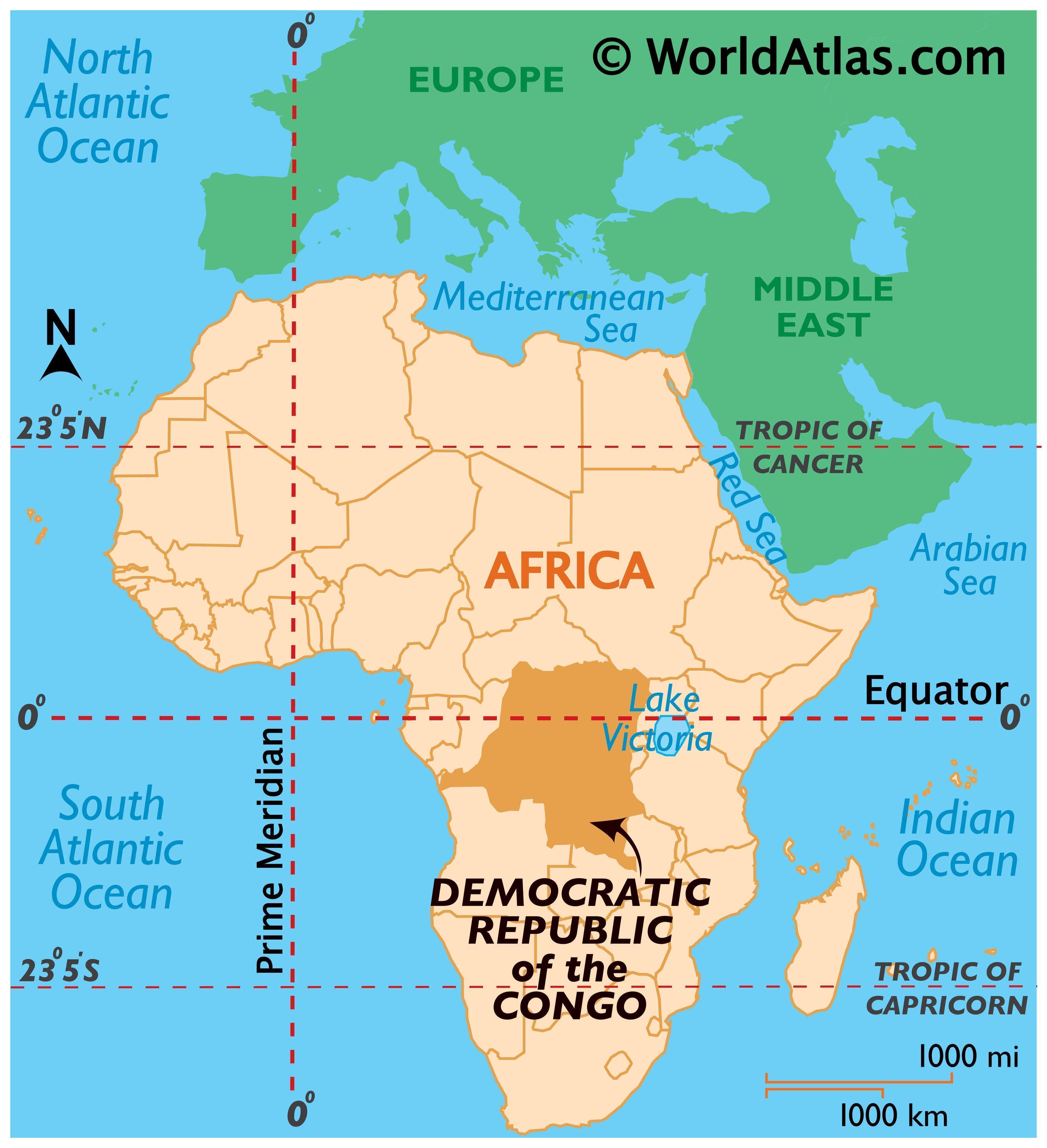
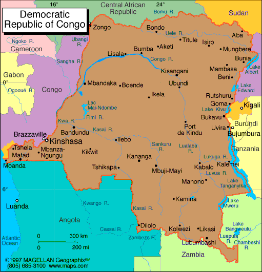
Democratic Republic of the Congo Map
Congo is located in the central-western part of
sub-Saharan Africa, along the Equator, lying between latitudes 4°N and 5°S, and
longitudes 11° and 19°E. To the south and east of it is the Democratic Republic
of Congo. It is also bounded by Gabon to the west, Cameroon and the Central
African Republic to the north, and Cabinda (Angola) to the southwest. It has a
short coast on the Atlantic Ocean.
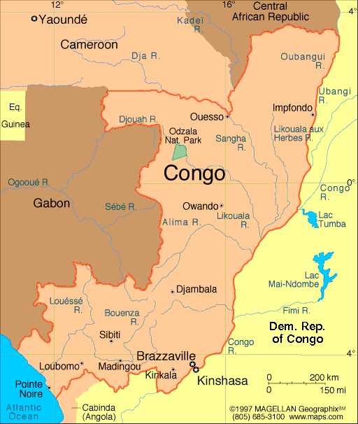
The capital, Brazzaville, is located on the
Congo River, in the south of the country, immediately across from Kinshasa, the
capital of the Democratic Republic of the Congo.
The southwest of the country is a coastal plain
for which the primary drainage is the Kouilou-Niari River; the interior of the
country consists of a central plateau between two basins to the south and
north. Forests are under increasing exploitation pressure.[30]
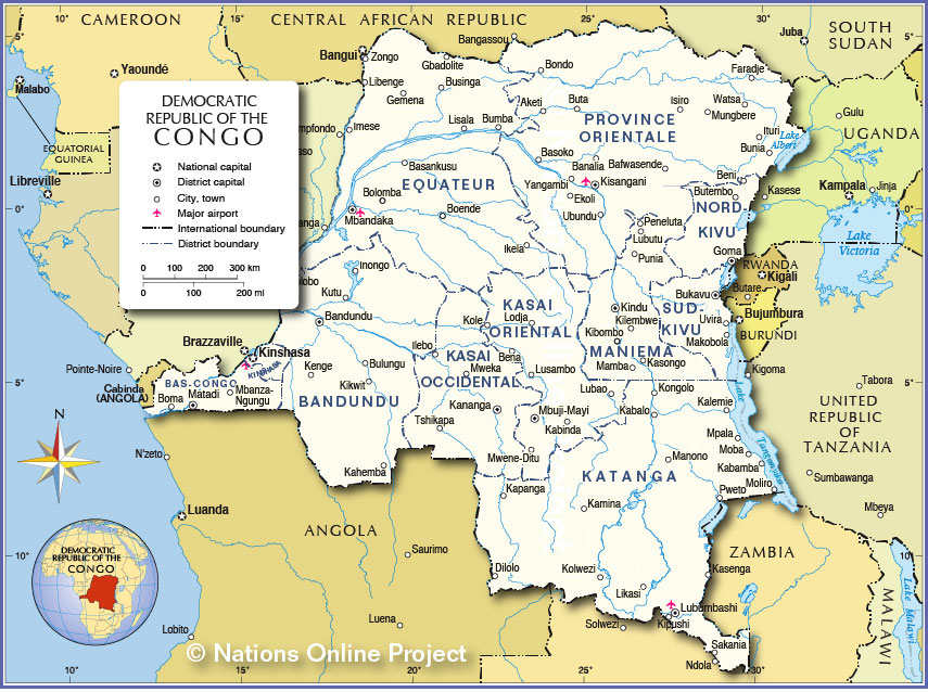
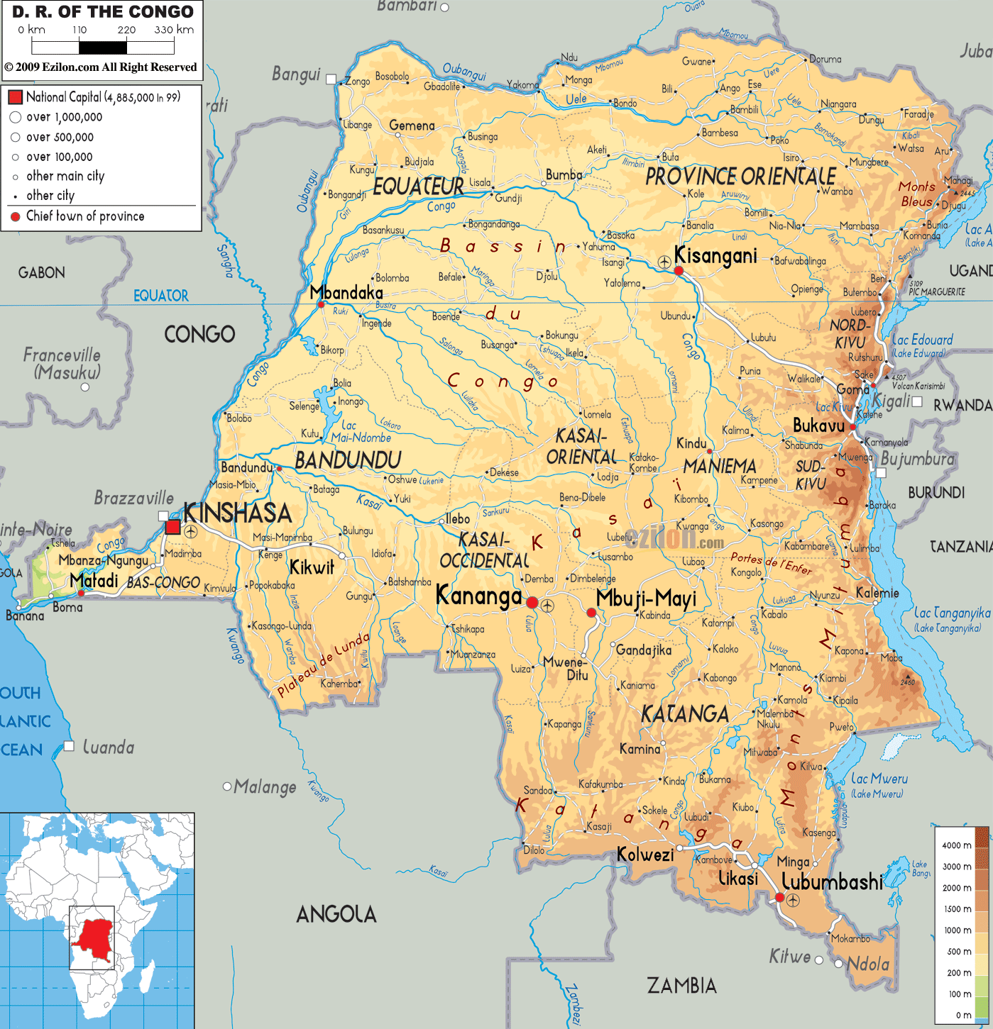
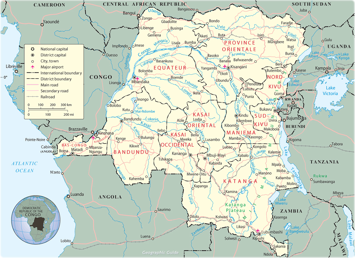
Political Map of Democratic Republic of the Congo

Since the country is located on the Equator, the climate is consistent year-round, with the average day temperature being a humid 24 °C (75 °F) and nights generally between 16 °C (61 °F) and 21 °C (70 °F). The average yearly rainfall ranges from 1,100 millimetres (43 in) in south in the Niari Valley to over 2,000 millimetres (79 in) in central parts of the country. The dry season is from June to August while in the majority of the country the wet season has two rainfall maxima: one in March–May and another in September–November.[31]
In 2006–07, researchers from the Wildlife Conservation Society studied gorillas in heavily forested regions centered on the Ouesso district of the Sangha Region. They suggest a population on the order of 125,000 Western Lowland Gorillas, whose isolation from humans has been largely preserved by inhospitable swamps.[32]
Administrative Map of Democratic Republic of the Congo
The economy is a mixture of village agriculture
and handicrafts, an industrial sector based largely on petroleum,[33] support
services, and a government characterized by budget problems and overstaffing.
Petroleum extraction has supplanted forestry as the mainstay of the economy. In
2008, oil sector accounted for 65% of the GDP, 85% of government revenue, and
92% of exports.[34] The country also has large untapped mineral wealth.
In the early 1980s, rapidly rising oil revenues
enabled the government to finance large-scale development projects with GDP
growth averaging 5% annually, one of the highest rates in Africa. The
government has mortgaged a substantial portion of its petroleum earnings,
contributing to a shortage of revenues. January 12, 1994 devaluation of Franc
Zone currencies by 50% resulted in inflation of 46% in 1994, but inflation has
subsided since.[35]
Political Map of Democratic Republic of Congo
Kinshasa seen from Brazzaville. The two capitals are separated by the Congo River.
Young women learning to sew, Brazzaville
Economic reform efforts continued with the support of international organizations, notably the World Bank and the International Monetary Fund. The reform program came to a halt in June 1997 when civil war erupted. When Sassou Nguesso returned to power at the end of the war in October 1997, he publicly expressed interest in moving forward on economic reforms and privatization and in renewing cooperation with international financial institutions. However, economic progress was badly hurt by slumping oil prices and the resumption of armed conflict in December 1998, which worsened the republic's budget deficit.
democratic-republic-of-congo- ...

The current administration presides over an uneasy internal peace and faces difficult economic problems of stimulating recovery and reducing poverty, despite record-high oil prices since 2003. Natural gas and diamonds are also recent major Congolese exports, although Congo was excluded from the Kimberley Process in 2004 amid allegations that most of its diamond exports were in fact being smuggled out of the neighboring Democratic Republic of Congo; it was re-admitted to the group in 2007.[36][37]
The Republic of the Congo also has large untapped base metal, gold, iron and phosphate deposits.[38] The country is a member of the Organization for the Harmonization of Business Law in Africa (OHADA).[39] The Congolese government signed an agreement in 2009 to lease 200,000 hectares of land to South African farmers to reduce its dependence on imports.[40][41]
The GDP of the Republic of the Congo grew by 6% in 2014 and is expected to have grown by 7.5% in 2015.[42][43]
Physical Map of Democratic Republic of Congo
Transport in the Republic of the Congo includes
land, air and water transportation. The country's rail system was built by
forced laborers during the 1930s and largely remains in operation. There are
also over 1000 km of paved roads and two major international airports
(Maya-Maya Airport and Pointe Noire Airport) which have flights to Paris and
many African cities. The country also has a large port on the Atlantic Ocean at
Pointe-Noire and others along the Congo River at Brazzaville and Impfondo.
Democratic Republic of the Congo Guide

The Republic of the Congo's sparse population
is concentrated in the southwestern portion of the country, leaving the vast
areas of tropical jungle in the north virtually uninhabited. Thus, Congo is one
of the most urbanized countries in Africa, with 70% of its total population
living in a few urban areas, namely in Brazzaville, Pointe-Noire or one of the
small cities or villages lining the 534-kilometre (332 mi) railway which
connects the two cities. In rural areas, industrial and commercial activity has
declined rapidly in recent years, leaving rural economies dependent on the
government for support and subsistence.[45]
map_of_republic-of-congo

Ethnically and linguistically the population of the Republic of the Congo is diverse—Ethnologue recognises 62 spoken languages in the country[46]—but can be grouped into three categories. The Kongo are the largest ethnic group and form roughly half of the population. The most significant subgroups of the Kongo are Laari in Brazzaville and Pool regions and Vili around Pointe-Noire and along the Atlantic coast. The second largest group are the Teke who live to the north of Brazzaville with 17% of the population. Boulangui (M’Boshi) live in the northwest and in Brazzaville and form 12% of the population.[47][48] Pygmies make up 2% of Congo's population.[49]
Before the 1997 war, about 9,000 Europeans and other non-Africans lived in Congo, most of whom were French; only a fraction of this number remains.[45] Around 300 American expatriates reside in the Congo.[45]
Democratic Republic of the Congo Map
The people of Republic of the Congo are largely a mix of Catholics (33.1%), Awakening Lutherans (22.3%) and Protestants (19.9%). Followers of Islam make up 1.6%, and this is primarily due to an influx of foreign workers into the urban centers.[1]
According to a 2011–12 survey, total fertility rate was 5.1 children born per woman, with 4.5 in urban areas and 6.5 in rural areas.[50]
Republic of Congo Atlas: Maps and Online Resources
Public expenditure health was at 8.9% of the
GDP in 2004, whereas private expenditure was at 1.3%.[51] As of 2012, the
HIV/AIDS prevalence was at 2.8% among 15- to 49-year-olds.[1] Health
expenditure was at US$30 per capita in 2004.[51] A large proportion of the
population is undernourished,[51] with malnutrition being a problem in
Congo-Brazzaville.[52] There were 20 physicians per 100,000 persons in the
early 2000s (decade).[51]
As of 2010, the maternal mortality rate was 560
deaths/100,000 live births, and the infant mortality rate was 59.34
deaths/1,000 live births.[1] Female genital mutilation (FGM) is rare in the
country, being confined to limited geographic areas of the country.[53]
Map of Republic of the Congo - Travel Africa
Public expenditure of the GDP was less in
2002–05 than in 1991.[51] Public education is theoretically free and mandatory
for under-16-year-olds,[54] but in practice, expenses exist.[54] Net primary
enrollment rate was 44% in 2005, much less than the 79% in 1991.[51] The
country has universities. Education between ages six and sixteen is compulsory.
Pupils who complete six years of primary school and seven years of secondary
school obtain a baccalaureate. At the university, students can obtain a
bachelor's degree in three years and a master's after four. Marien Ngouabi
University—which offers courses in medicine, law and several other fields—is
the country's only public university. Instruction at all levels is in French,
and the educational system as a whole models the French system. The educational
infrastructure has been seriously degraded as a result of political and
economic crises. There are no seats in most classrooms, forcing children to sit
on the floor. Enterprising individuals have set up private schools, but they
often lack the technical knowledge and familiarity with the national curriculum
to teach effectively. Families frequently enroll their children in private
schools only to find they cannot make the payments.
Democratic Republic of the Congo Atlas
Outline of the Republic of the Congo

Map of Democratic Republic of the Congo - Travel Africa
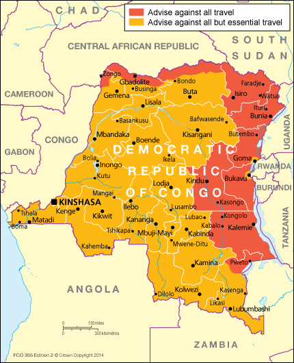
Democratic Republic of Congo travel advice
Location map Republic of the Congo

Health Information for Travelers to Republic of the Congo
Democratic Republic of Congo

Hiç yorum yok:
Yorum Gönder