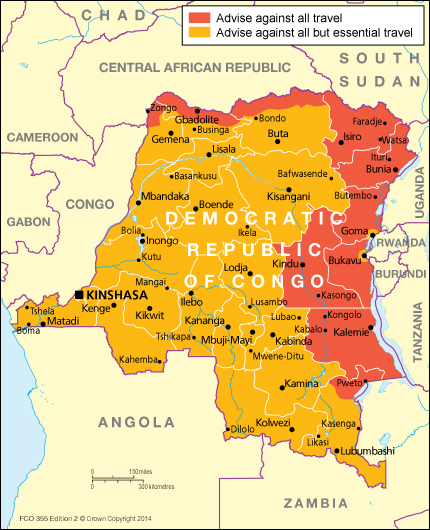
Democratic Republic of the Congo Map
In July 1960, there were six provinces in the
Belgian Congo: Leopoldville Province, Equateur Province, Province Orientale,
Kivu Province, Katanga Province, and Kasai Province. Kivu Province existed from
1933 to 1962 (under the name Province de Costermansville until 1947, from the
name of its capital) and from 1966 to 1988.
There are currently ten provinces and one
city-province in the Democratic Republic of the Congo:
Democratic Republic of Congo travel advice
Article 2[2] of the 2005 Congolese Constitution,[3]
which came into effect on 18 February 2006, specifies twenty-five new provinces
while retaining the capital city/province of Kinshasa. Though this new
territorial organization was scheduled to take effect within thirty-six months
of the new constitution's promulgation, it did not. President Joseph Kabila has
set a deadline of June 30, 2015 to complete this process, known as
découpage.[4]
Political Map of Democratic Republic of the Congo
The twenty-five provinces denoted by the 2005 constitution are as follows: Bas-Uele, Equateur, Haut-Lomami, Haut-Katanga, Haut-Uele, Ituri, Kasai, Kasai Oriental, Kongo central, Kwango, Kwilu, Lomami, Lualaba, Lulua, MaiNdombe, Maniema, Mongala, Nord-Kivu, Nord-Ubangi, Sankuru, Sud Kivu, Sud Ubangi, Tanganyika, Tshopo, Tshuapa. [5]


Hiç yorum yok:
Yorum Gönder