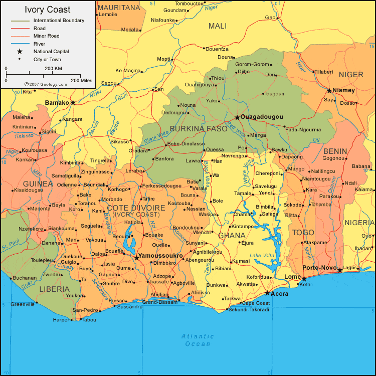
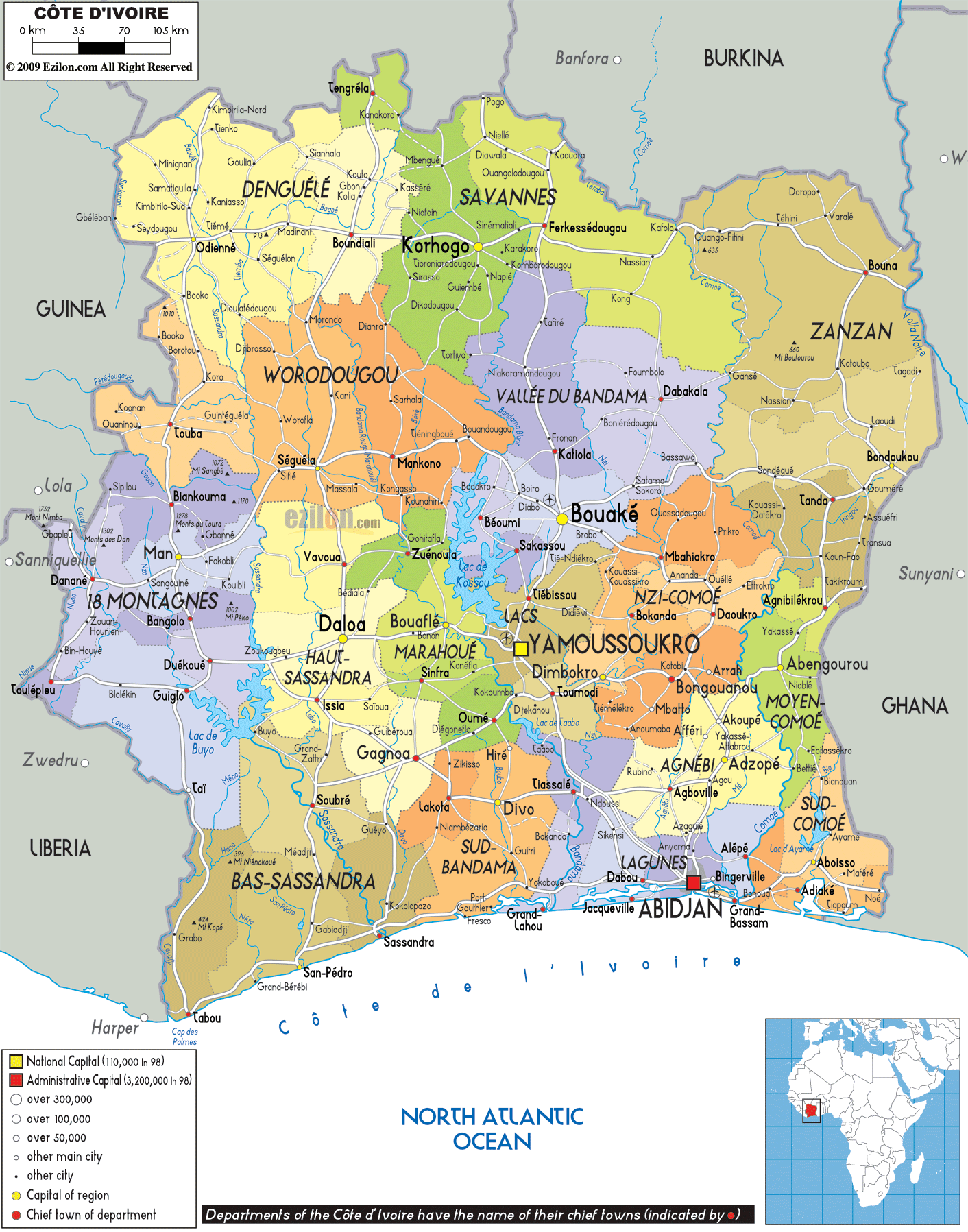
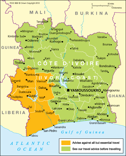
Ivory Coast Map - Ivory Coast
Ivory Coast (Listeni/ˌaɪvəri ˈkoʊst/) or Côte d'Ivoire
(/ˌkoʊt dɨˈvwɑr/;[7] koht dee-vwahr; French: [kot divwaʁ] ( listen)),
officially the Republic of Côte d'Ivoire (French: République de Côte d'Ivoire),
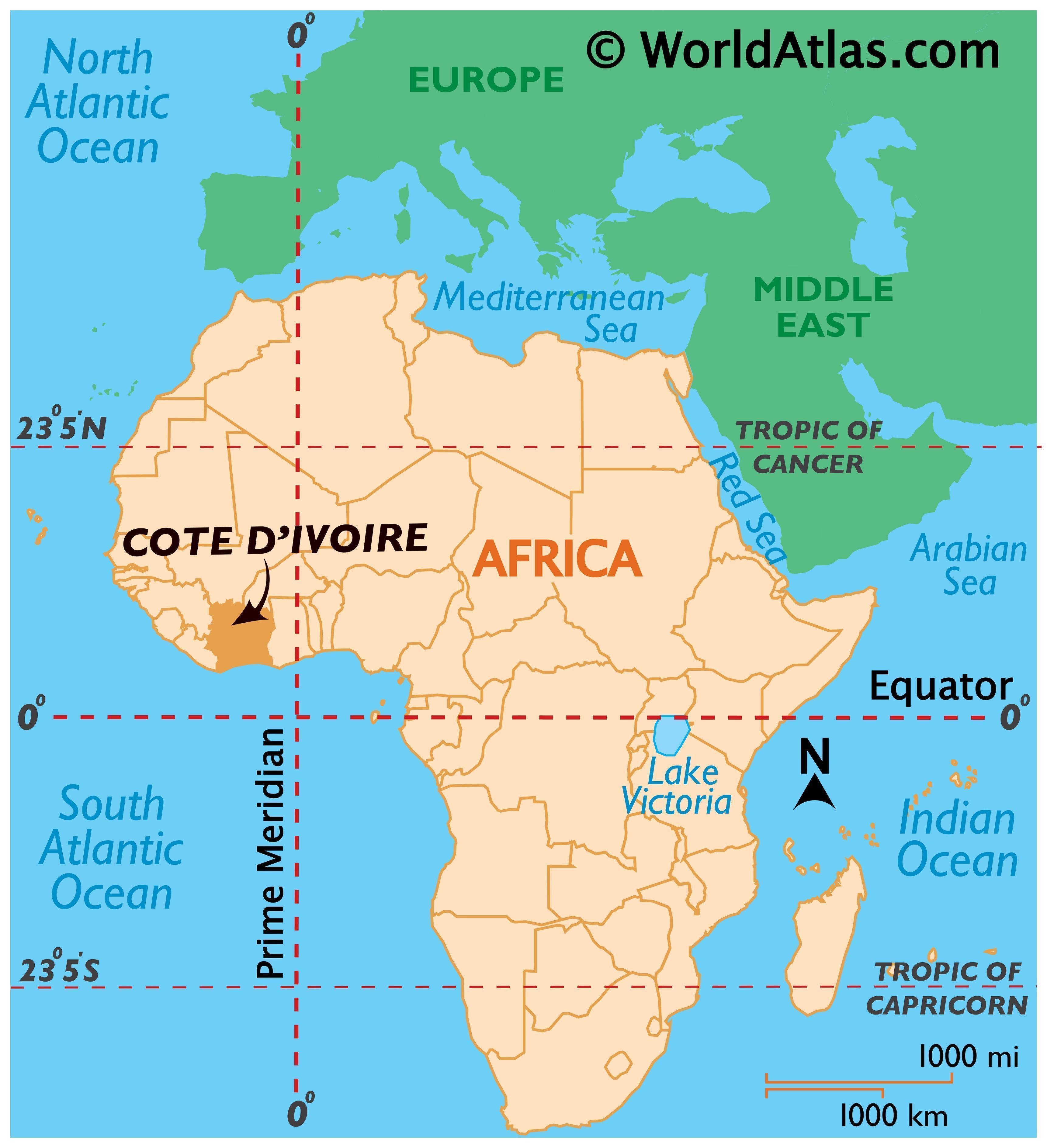
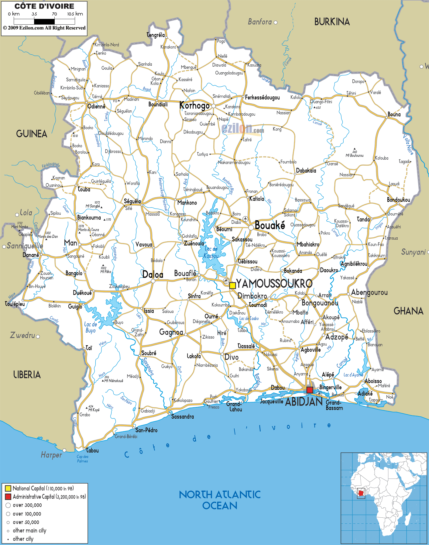
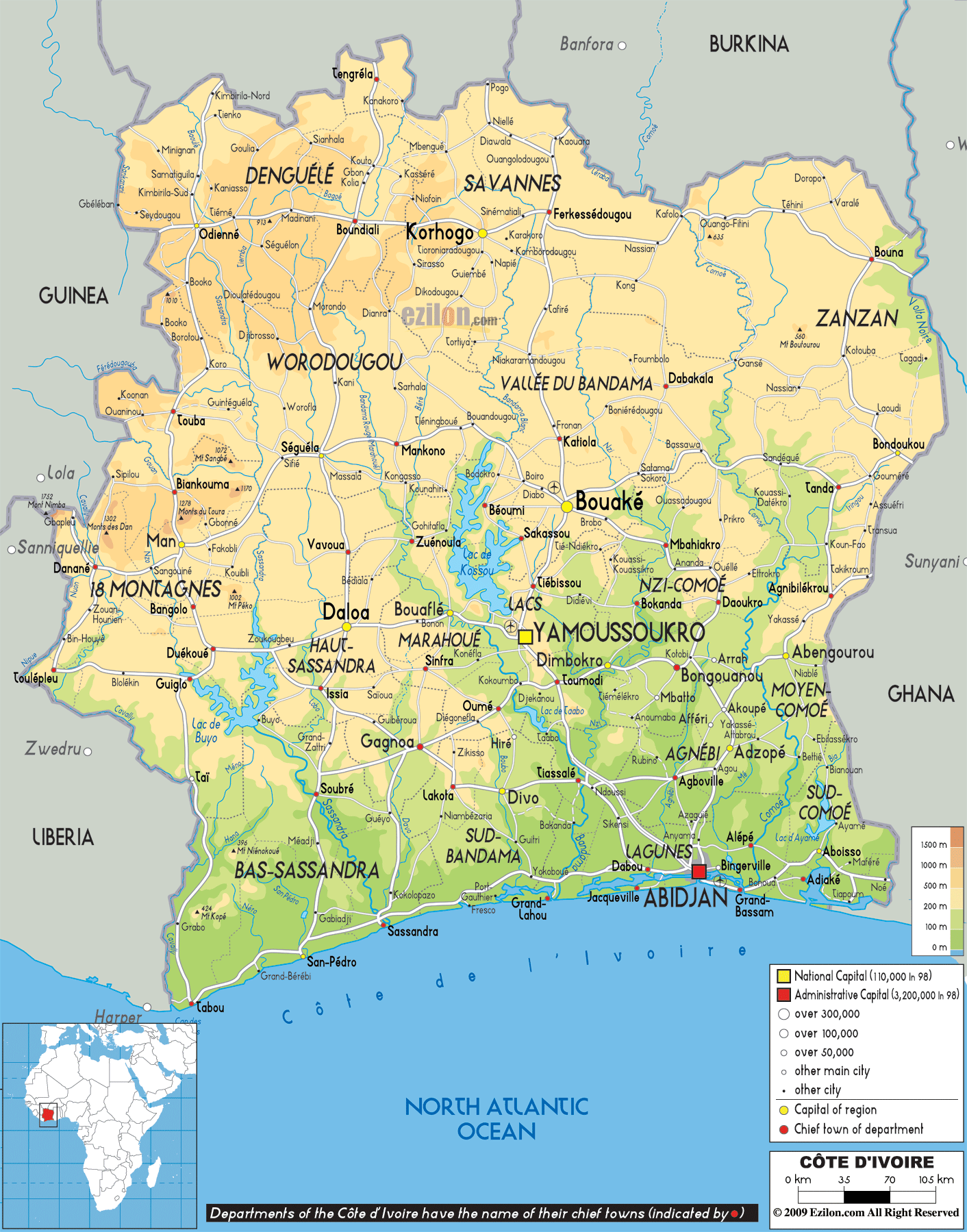
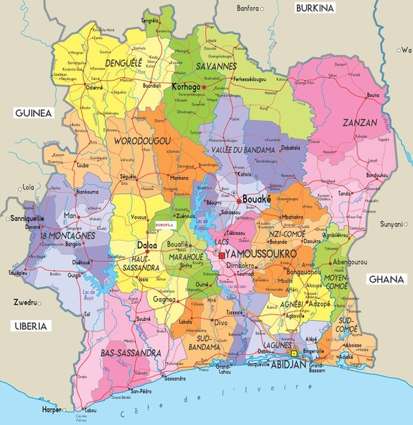
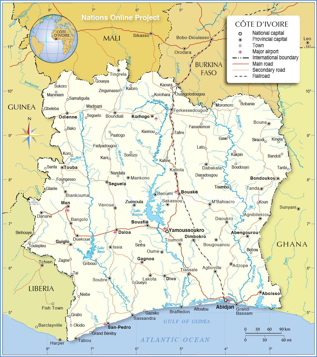
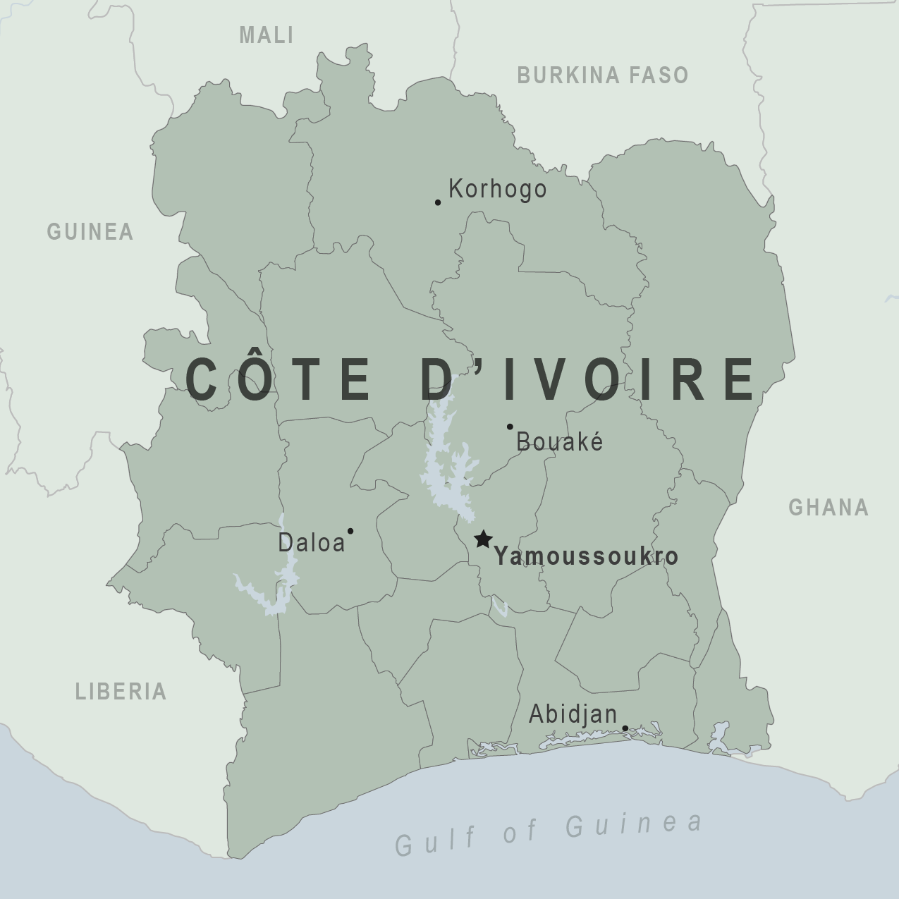
is a country in West Africa. Ivory Coast's political capital is Yamoussoukro,
and its economic capital and largest city is the port city of Abidjan.
Ivory Coast Map - Ivory Coast
Prior to its colonization by Europeans, Ivory Coast was home to several states, including Gyaaman, the Kong Empire, and Baoulé. Two Anyi kingdoms, Indénié and Sanwi, attempted to retain their separate identity through the French colonial period and after independence.[8] Ivory Coast became a protectorate of France in 1843–44 and was later formed into a French colony in 1893 amid the European scramble for Africa. Ivory Coast achieved independence in 1960, led by Félix Houphouët-Boigny, who ruled the country until 1993. It maintained close political and economic association with its West African neighbors while at the same time maintaining close ties to the West, especially France. Since the end of Houphouët-Boigny's rule in 1993, Ivory Coast has experienced one coup d'état, in 1999, and two religion-grounded civil wars. The first took place between 2002 and 2007[9] and the second during 2010-2011.
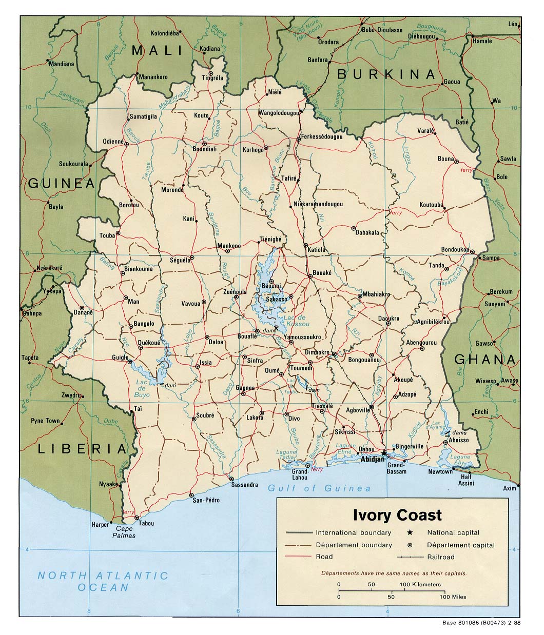
Road Map of Ivory Coast
Ivory Coast is a republic with a strong executive power invested in its president. Through the production of coffee and cocoa, the country was an economic powerhouse in West Africa during the 1960s and 1970s. Ivory Coast went through an economic crisis in the 1980s, contributing to a period of political and social turmoil. The 21st-century Ivorian economy is largely market-based and still relies heavily on agriculture, with smallholder cash-crop production being dominant.[1]
Physical Map of Ivory Coast
The official language is French, with local indigenous languages also widely used, including Baoulé, Dioula, Dan, Anyin, and Cebaara Senufo. The main religions are Islam, Christianity (primarily Roman Catholicism), and various indigenous religions.
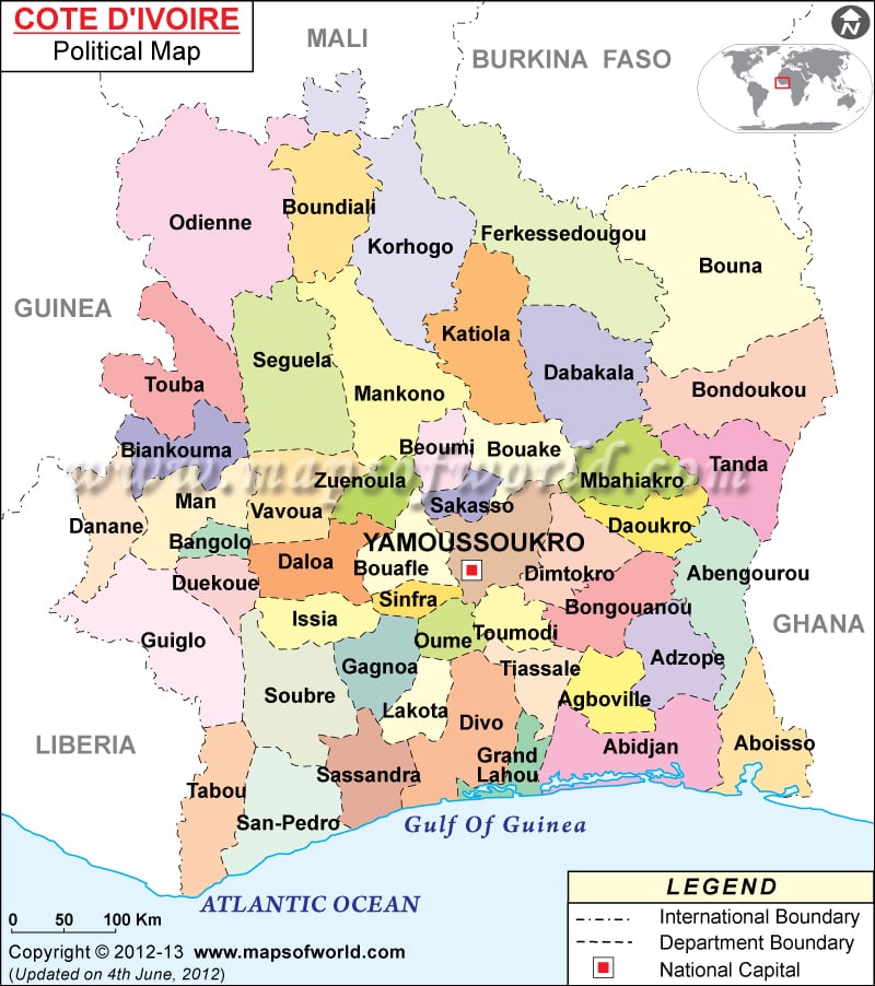
Political Map of Ivory Coast
Portuguese and French merchant-explorers in the 15th
and 16th centuries divided the west coast of Africa, very roughly, into five
"coasts" reflecting local economies. The coast that the French named
the Côte d'Ivoire and the Portuguese named the Costa do Marfim—both, literally,
being "Ivory Coast"—lay between what was known as the Guiné de Cabo
Verde, so-called "Upper Guinea" at Cabo Verde, and Lower
Guinea.[10][11] There was also a "Grain Coast", a "Gold
Coast", and a "Slave Coast". Like those three, the name
"Ivory Coast" reflected the major trade that occurred on that
particular stretch of the coast, the export of ivory.[12][10][13][14][15]
Ivory Coast Map - Ivory Coast
Other names for the coast of ivory included the Côte de Dents,[n 1] literally "Teeth Coast", again reflecting the trade in ivory;[17][18][12][11][15][19] the Côte de Quaqua, after the people whom the Dutch named the Quaqua (alternatively Kwa Kwa);[18][10][16] the Coast of the Five and Six Stripes, after a type of cotton fabric also traded there;[18] and the Côte du Vent[n 2], the Windward Coast, after perennial local off-shore weather conditions.[12][10] One can find the name Cote de(s) Dents regularly used in older works.[18] It was used in Duckett's Dictionnaire (Duckett 1853) and by Nicolas Villault de Bellefond, for examples, although Antoine François Prévost used Côte d'Ivoire.[19] In the 19th century, it died out in favor of Côte d'Ivoire.[18]
The coastline of the modern state is not quite coterminous with what the 15th- and 16th-century merchants knew as the "Teeth" or "Ivory" coast, which was considered to stretch from Cape Palmas to Cape Three Points and which is thus now divided between the modern states of Ghana and Ivory Coast (with a minute portion of Liberia).[17][13][19][16] It retained the name through French rule, though, and independence in 1960.[20] The name had long since been translated literally into other languages,[n 3] which the postindependence government considered to be increasingly troublesome whenever its international dealings extended beyond the Francophone sphere. Therefore, in April 1986, the government declared Côte d'Ivoire (or, more fully, République de Côte d'Ivoire[22]) to be its formal name for the purposes of diplomatic protocol, and officially refuses to recognize or accept any translation from French to another language in its international dealings.[21][23][24]
Despite the Ivorian government's request, the English translation "Ivory Coast" (often "the Ivory Coast") is still frequently used in English, by various media outlets and publications.[n 4][n 5]
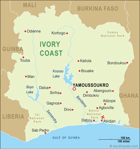
Ivory Coast Map, Ivory Coast Travel Maps from Word Travels
The first human presence in Ivory Coast has been
difficult to determine because human remains have not been well preserved in
the country's humid climate. However, the presence of newly found weapon and
tool fragments (specifically, polished axes cut through shale and remnants of
cooking and fishing) has been interpreted as a possible indication of a large
human presence during the Upper Paleolithic period (15,000 to 10,000 BC),[30]
or at the minimum, the Neolithic period.[31]
The earliest known inhabitants of Ivory Coast have
left traces scattered throughout the territory. Historians believe that they
were all either displaced or absorbed by the ancestors of the present
indigenous inhabitants, who migrated south into the area before the 16th century.
Such groups included the Ehotilé (Aboisso), Kotrowou (Fresco), Zéhiri (Grand
Lahou), Ega and Diès (Divo).[32]
The first recorded history is found in the chronicles
of North African (Berber) traders, who, from early Roman times, conducted a
caravan trade across the Sahara in salt, slaves, gold, and other goods. The
southern terminals of the trans-Saharan trade routes were located on the edge
of the desert, and from there supplemental trade extended as far south as the
edge of the rain forest. The more important terminals—Djenné, Gao, and
Timbuctu—grew into major commercial centres around which the great Sudanic empires
developed.

By controlling the trade routes with their powerful military forces, these empires were able to dominate neighbouring states. The Sudanic empires also became centres of Islamic education. Islam had been introduced in the western Sudan (today's Mali) by Muslim Berber traders from North Africa; it spread rapidly after the conversion of many important rulers. From the 11th century, by which time the rulers of the Sudanic empires had embraced Islam, it spread south into the northern areas of contemporary Ivory Coast.
Ivory Coast maps
The Ghana empire, the earliest of the Sudanic empires, flourished in present-day eastern Mauritania from the fourth to the 13th centuries. At the peak of its power in the 11th century, its realms extended from the Atlantic Ocean to Timbuctu. After the decline of Ghana, the Mali Empire grew into a powerful Muslim state, which reached its apogee in the early part of the 14th century. The territory of the Mali Empire in Ivory Coast was limited to the north-west corner around Odienné.
Abidjan, Ivory Coast - Discount Cruises, Last-Minute Cruises

Its slow decline starting at the end of the 14th century followed internal discord and revolts by vassal states, one of which, Songhai, flourished as an empire between the 14th and 16th centuries. Songhai was also weakened by internal discord, which led to factional warfare. This discord spurred most of the migrations of peoples southward toward the forest belt. The dense rain forest, covering the southern half of the country, created barriers to the large-scale political organizations that had arisen in the north. Inhabitants lived in villages or clusters of villages; their contacts with the outside world were filtered through long-distance traders. Villagers subsisted on agriculture and hunting.
Since 1983, Ivory Coast's capital has been
Yamoussoukro. Abidjan is the administrative center. Most countries maintain
their embassies in Abidjan. The Ivoirian population continues to suffer because
of an ongoing civil war. International human-rights organizations have noted
problems with the treatment of captive noncombatants by both sides and the
re-emergence of child slavery among workers in cocoa production.
Although most of the fighting ended by late 2004, the
country remained split in two, with the north controlled by the New Forces. A
new presidential election was expected to be held in October 2005, and an
agreement was reached among the rival parties in March 2007 to proceed with
this, but it continued to be postponed until November 2010 due to delays in its
preparation.
Ivory Coast Map with cities - blank outline map of Ivory Coast

Elections were finally held in 2010. The first round of elections was held peacefully, and widely hailed as free and fair. Runoffs were held 28 November 2010, after being delayed one week from the original date of 21 November. Laurent Gbagbo as president ran against former Prime Minister Alassane Ouattara.[57]
Worldpress.org - Ivory Coast Profile

On 2 December, the Electoral Commission declared that Ouattara had won the election by a margin of 54% to 46%. In response, the Gbagbo-aligned Constitutional Council rejected the declaration, and the government announced that country's borders had been sealed. An Ivorian military spokesman said, "The air, land, and sea border of the country are closed to all movement of people and goods."[58]
File:Ivory-coast-map.gif - Wikipedia, the free encyclopedia

Ivory Coast has, for the region, a relatively high
income per capita (US$1014.4 in 2013) and plays a key role in transit trade for
neighboring, landlocked countries. The country is the largest economy in the
West African Economic and Monetary Union, constituting 40% of the monetary
union’s total GDP. The country is the world's largest exporter of cocoa beans,
and the fourth-largest exporter of goods, in general, in sub-Saharan Africa
(following South Africa, Nigeria, and Angola).[61]

In 2009, the cocoa-bean farmers earned $2.53 billion for cocoa exports and were expected to produce 630,000 metric tons in 2013.[62][63] According to the Hershey Company, the price of cocoa beans is expected to rise dramatically in upcoming years.[64] The Ivory Coast also has 100,000 rubber farmers who earned a total of $105 million in 2012.[65][66]
The maintenance of close ties to France since independence in 1960, diversification of agriculture for export, and encouragement of foreign investment have been factors in the economic growth of Ivory Coast. In recent years, Ivory Coast has been subject to greater competition and falling prices in the global marketplace for its primary agricultural crops: coffee and cocoa. That, compounded with high internal corruption, makes life difficult for the grower, those exporting into foreign markets, and the labor force, inasmuch as instances of indentured labor have been reported in the cocoa and coffee production in every edition of the U.S. Department of Labor's List of Goods Produced by Child Labor or Forced Labor since 2009.[67]
Ivory Coast maps

Ethnic groups include Akan 42.1%, Voltaiques or Gur
17.6%, Northern Mandes 16.5%, Krous 11%, Southern Mandes 10%, other 2.8%
(includes 30,000 Lebanese and 45,000 French; 2004). About 77% of the population
is considered Ivoirian.
Since Ivory Coast has established itself as one of the
most successful West African nations, about 20% of the population (about 3.4
million) consists of workers from neighbouring Liberia, Burkina Faso, and
Guinea.
Ivory Coast Region Map, Region Map of Ivory Coast

About 4% of the population is of non-African ancestry. Many are French,[71] Lebanese,[72] Vietnamese and Spanish citizens, as well as Protestant missionaries from the United States and Canada. In November 2004, around 10,000 French and other foreign nationals evacuated Ivory Coast due to attacks from progovernment youth militias.[73] Aside from French nationals, native-born descendants of French settlers who arrived during the country's colonial period are present.
Hiç yorum yok:
Yorum Gönder