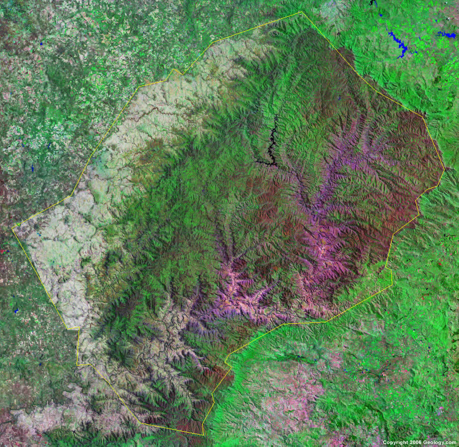
Lesotho Map - Lesotho Satellite Image - Physical - Political
Lesotho (Listeni/lɨˈsuːtuː/; li-soo-too), officially
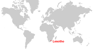
the Kingdom of Lesotho (Sotho: 'Muso oa Lesotho), is an enclaved, landlocked
country in southern Africa completely surrounded by South Africa. It is just
over 30,000 km2 (11,583 sq mi) in size and has a population slightly over two
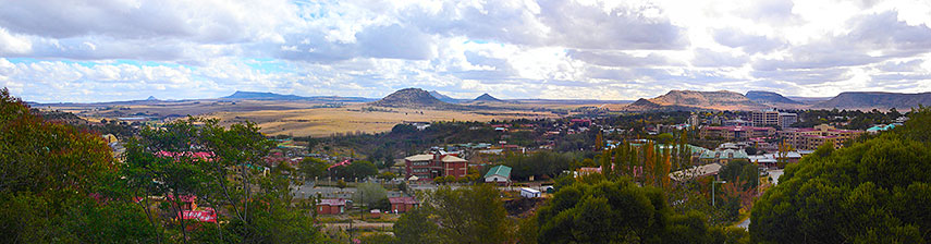
million.[1] Its capital and largest city is Maseru. Lesotho is a member of the
Commonwealth of Nations. The name Lesotho translates roughly into the land of
the people who speak Sesotho.[5] About 40% of the population lives below the
international poverty line of US $1.25 a day.[6]
satellite-3d-map-of-lesotho- ...

The present Lesotho, then called Basutoland, emerged
as a single polity under King Moshoeshoe I in 1822. Moshoeshoe, a son of
Mokhachane, a minor chief of the Bakoteli lineage, formed his own clan and
became a chief around 1804. Between 1821 and 1823, he and his followers settled
at the Butha-Buthe Mountain, joining with former adversaries in resistance
against the Lifaqane associated with the reign of Shaka Zulu from 1818 to 1828.
Subsequent evolution of the state hinged on conflicts
between British and Dutch colonists leaving the Cape Colony following its
seizure from the French-allied Dutch by the British in 1795, and subsequently
associated with the Orange River Sovereignty and subsequent Orange Free State.
Missionaries invited by Moshoeshoe I, Thomas Arbousset, Eugène Casalis and
Constant Gosselin from the Paris Evangelical Missionary Society, placed at
Morija, developed orthography and printed works in the Sesotho language between
1837 and 1855. Casalis, acting as translator and providing advice on foreign
affairs, helped to set up diplomatic channels and acquire guns for use against
the encroaching Europeans and the Griqua people.
Free Political Map of Lesotho, satellite outside

Trekboers from the Cape Colony showed up on the western borders of Basutoland and claimed land rights, beginning with Jan de Winnaar, who settled in the Matlakeng area in May–June 1838. As more Boers were moving into the area they tried to colonise the land between the two rivers, even north of the Caledon, claiming that it had been abandoned by the Sotho people. Moshoeshoe subsequently signed a treaty with the British Governor of the Cape Colony, Sir George Thomas Napier, that annexed the Orange River Sovereignty that many Boers had settled. These outraged Boers were suppressed in a brief skirmish in 1848. In 1851 a British force was defeated by the Basotho army at Kolonyama, touching off an embarrassing war for the British. After repelling another British attack in 1852, Moshoeshoe sent an appeal to the British commander that settled the dispute diplomatically, then defeated the Batlokoa in 1853.
Free Political 3D Map of Lesotho, satellite outside

In 1854 the British pulled out of the region, and in 1858 Moshoeshoe fought a series of wars with the Boers in the Free State–Basotho War, losing a great portion of the western lowlands. The last war in 1867 ended when Moshoeshoe appealed to Queen Victoria, who agreed to make Basutoland a British protectorate in 1868. In 1869, the British signed a treaty at Aliwal North with the Boers that defined the boundaries of Basutoland, and later Lesotho, which by ceding the western territories effectively reduced Moshoeshoe's Kingdom to half its previous size.
Free Political Map of Lesotho, satellite outside

Following the cession in 1869, the British initially transferred functions from Moshoeshoe's capital in Thaba Bosiu to a police camp on the northwest border, Maseru, until administration of Basutoland was transferred to the Cape Colony in 1871. Moshoeshoe died on 11 March 1870, marking the end of the traditional era and the beginning of the colonial era. He was buried at Thaba Bosiu. In the early years of British rule between 1871 and 1884, Basutoland was treated similarly to other territories that had been forcefully annexed, much to the chagrin of the Basotho.[7] This led to the Gun War in 1881.[8] In 1884, Basutoland was restored its status as a protectorate, with Maseru again its capital, but remained under direct rule by a governor, though effective internal power was wielded by traditional chiefs.
Free Physical Map of Lesotho, satellite outside

The Lesotho Government is a parliamentary or
constitutional monarchy. The Prime Minister, Pakalitha Mosisili, is head of
government and has executive authority. The King of Lesotho, Letsie III, serves
a largely ceremonial function; he no longer possesses any executive authority
and is prohibited from actively participating in political initiatives.
The Democratic Congress leads a coalition government
in the National Assembly, the lower house of parliament.
The upper house of parliament, called the Senate, is
composed of twenty-two principal chiefs whose membership is hereditary, and
eleven appointees of the king, acting on the advice of the prime minister.
Lesotho Map - Lesotho Satellite Image - Physical - Political
The constitution provides for an independent judicial system, made up of the High Court, the Court of Appeal, Magistrate's Courts, and traditional courts that exist predominantly in rural areas. All but one of the Justices on the Court of Appeal are South African jurists. There is no trial by jury; rather, judges make rulings alone or, in the case of criminal trials, with two other judges as observers.
political-shades-map-of- ...

The constitution also protects basic civil liberties, including freedom of speech, freedom of association, freedom of the press, freedom of peaceful assembly and freedom of religion. Lesotho was ranked 12th out of 48 sub-Saharan African countries in the 2008 Ibrahim Index of African Governance.[13]
Google Map of Lesotho - Nations Online Project
As of 2010 the People's Charter Movement called for the practical annexation of the country by South Africa due to the AIDS epidemic. Nearly a quarter of the population is infected with HIV.[14] The country faced high unemployment, economic collapse, a weak currency and poor travel documents restricting movement. An African Union report called for economic integration of Lesotho with South Africa but stopped short of suggesting annexation. In May 2010 the Charter Movement delivered a petition to the South African High Commission requesting integration. South Africa's home affairs spokesman Ronnie Mamoepa rejected the idea that Lesotho should be treated as a special case. "It is a sovereign country like South Africa. We sent envoys to our neighbours – Botswana, Zimbabwe, Swaziland and Lesotho – before we enforced the passport rule. When you travel from Britain to South Africa, don't you expect to use a passport?"[15]
Lesotho Map - Lesotho Satellite

Satellite 3D Map of Lesotho

Lesotho's geographic location makes it extremely
vulnerable to political and economic developments in South Africa. It is a
member of many regional economic organisations, including the Southern African
Development Community (SADC),[16] and the Southern African Customs Union
(SACU).[17] It is also active in the United Nations (UN), the African Union,
the Non-Aligned Movement, the Commonwealth, and many other international
organisations.[citation needed]
Prince Seeiso Hirohr Seeiso is the present High Commissioner
of the Kingdom of Lesotho to the Court of St. James's. The UN is represented by
a resident mission as well, including UNDP, UNICEF, WHO, FAO, WFP, UNFPA and
UNAIDS.
physical-3d-map-of-lesotho- ...

Lesotho also has maintained ties with the United Kingdom (Wales in particular), Germany, the United States and other Western states. Although in 1990 it broke relations with the People's Republic of China (PRC) and re-established relations with the Republic of China (Taiwan), it later restored ties with the PRC.
Lesotho also recognises the State of Palestine[18] and the Republic of Kosovo.[19]
In the past, it was a strong public opponent of apartheid in South Africa and granted a number of South African refugees political asylum during the apartheid era.[18]
Lesotho on Google Map,

Google Map of Maseru, Lesotho
Lesotho Map

Hiç yorum yok:
Yorum Gönder