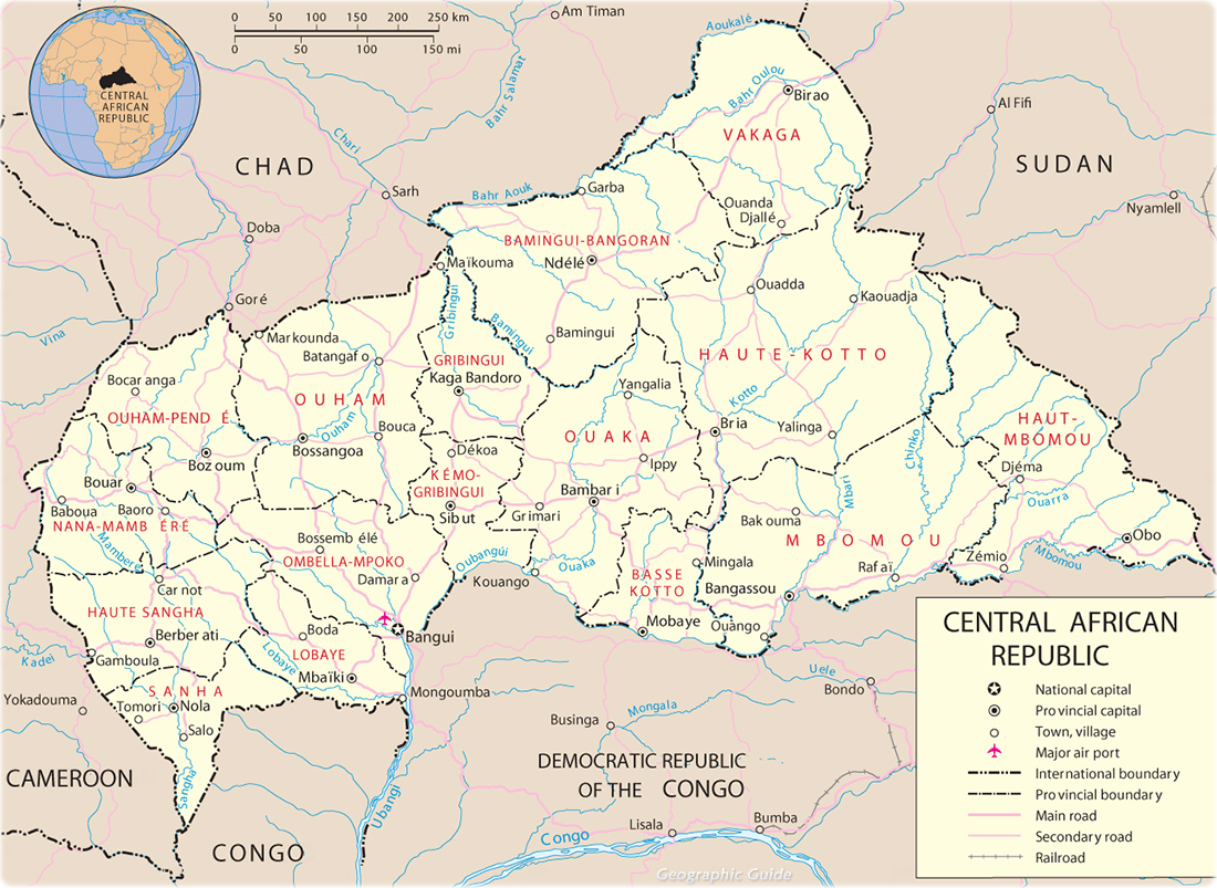
Outline of the Central African Republic
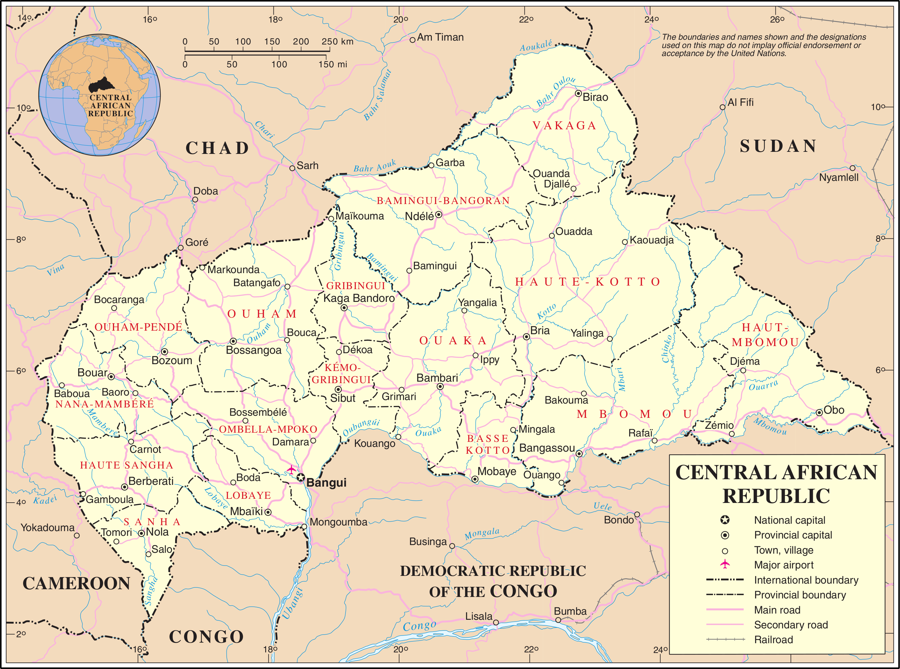
The Central African
Republic (CAR; Sango: Ködörösêse tî Bêafrîka; French: République
centrafricaine pronounced: [ʁepyblik sɑ̃tʁafʁikɛn],
or Centrafrique [sɑ̃tʀafʁik]) is a landlocked country in Central Africa. It is
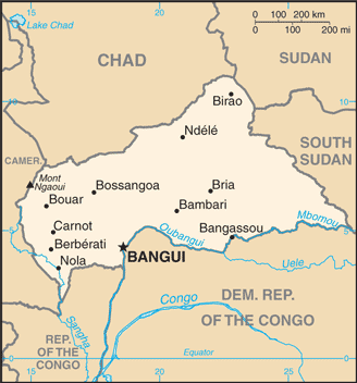
bordered by Chad to the north, Sudan to the northeast, South Sudan to the east,
the Democratic Republic of the Congo and the Republic of the Congo to the south
and Cameroon to the west. The CAR covers a land area of about 620,000 square
kilometres (240,000 sq mi) and had an estimated population of around 4.7
million as of 2014.
Most of the CAR consists of Sudano-Guinean savannas, but the
country also includes a Sahelo-Sudanian zone in the north and an equatorial
forest zone in the south. Two thirds of the country is within the Ubangi River
basin (which flows into the Congo), while the remaining third lies in the basin
of the Chari, which flows into Lake Chad.
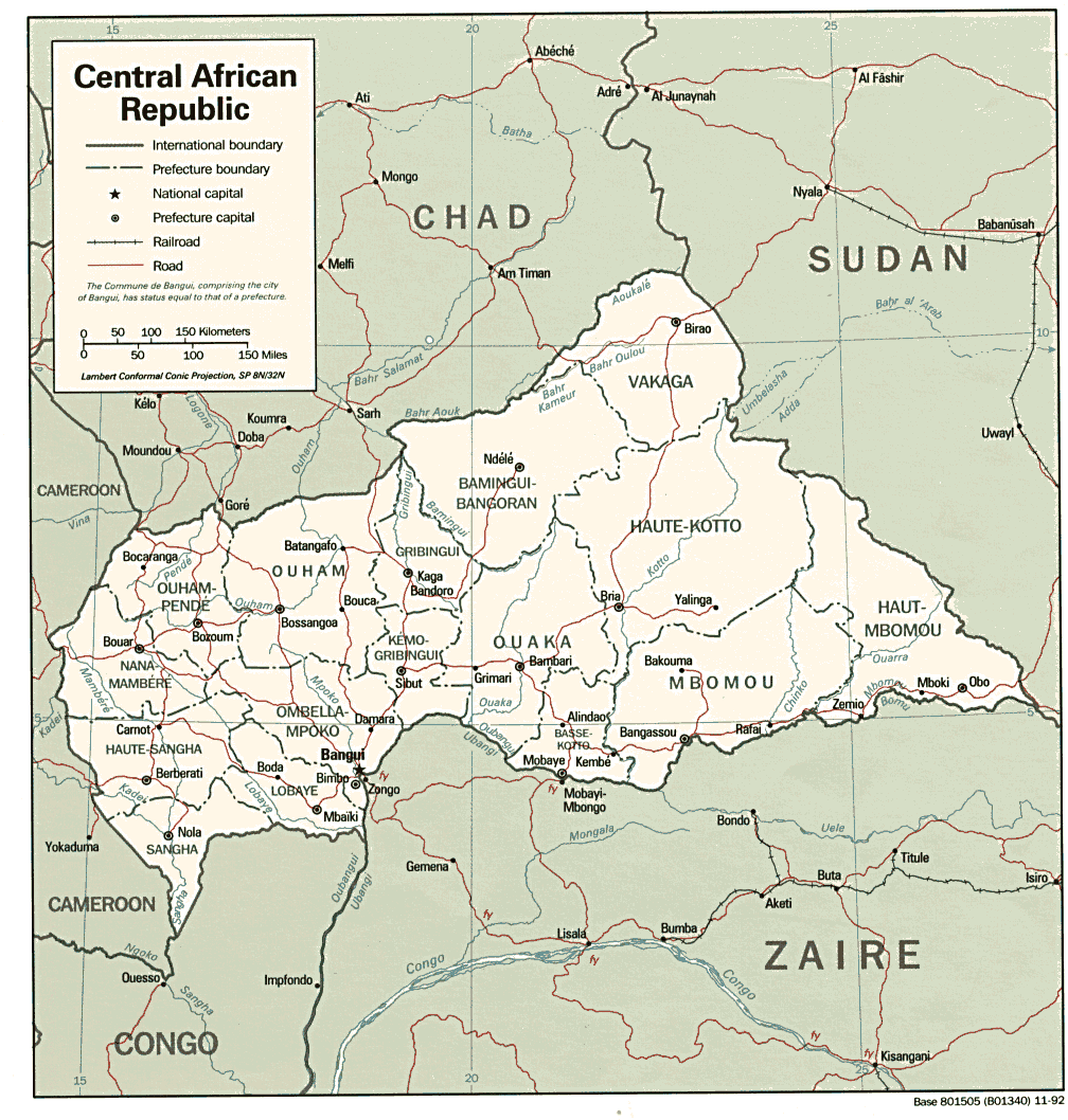
Map of Central African Republic - Travel Africa
What is today the Central African Republic has been inhabited for millennia; however, the country's current borders were established by France, which ruled the country as a colony starting in the late 19th century. After gaining independence from France in 1960, the Central African Republic was ruled by a series of autocratic leaders; by the 1990s, calls for democracy led to the first multi-party democratic elections in 1993. Ange-Félix Patassé became president, but was later removed by General François Bozizé in the 2003 coup. The Central African Republic Bush War began in 2004 and, despite a peace treaty in 2007 and another in 2011, fighting broke out between government, Muslim, and Christian factions in December 2012, leading to ethnic and religious cleansing and massive population displacement in 2013 and 2014.
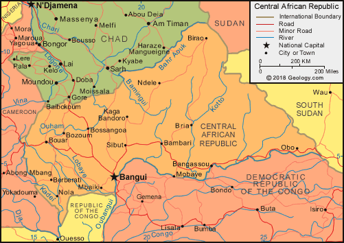
Road Map of Central Africa Republic
Despite its significant mineral deposits and other resources, such as uranium reserves, crude oil, gold, diamonds, lumber, and hydropower,[7] as well as significant quantities of arable land, the Central African Republic is among the ten poorest countries in the world. As of 2014, according to the Human Development Index (HDI), the country had the second lowest level of human development, ranking 187th out of 188 countries.[5]
Physical Map of Central Africa Republic
Approximately 10,000 years ago, desertification forced
hunter-gatherer societies south into the Sahel regions of northern Central
Africa, where some groups settled and began farming as part of the Neolithic
Revolution.[8] Initial farming of white yam progressed into millet and sorghum,
and before 3000 BC[9] the domestication of African oil palm improved the
groups' nutrition and allowed for expansion of the local populations.[10]
Bananas arrived in the region and added an important source of carbohydrates to
the diet; they were also used in the production of alcoholic beverages.[when?]
This Agricultural Revolution, combined with a "Fish-stew Revolution",
in which fishing began to take place, and the use of boats, allowed for the
transportation of goods. Products were often moved in ceramic pots, which are
the first known examples of artistic expression from the region's
inhabitants.[8]
Central African Republic Maps
The Bouar Megaliths in the western region of the country indicate an advanced level of habitation dating back to the very late Neolithic Era (c. 3500–2700 BC).[11][12] Ironworking arrived in the region around 1000 BC from both Bantu cultures in what is today Nigeria and from the Nile city of Meroë, the capital of the Kingdom of Kush.[13]
During the Bantu Migrations from about 1000 BC to AD 1000, Ubangian-speaking people spread eastward from Cameroon to Sudan, Bantu-speaking people settled in the southwestern regions of the CAR, and Central Sudanic-speaking people settled along the Ubangi River in what is today Central and East CAR.[citation needed]
Production of copper, salt, dried fish, and textiles dominated the economic trade in the Central African region.[14]
Listen to the silent crisis in the Central Africa Republic -

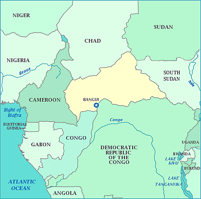
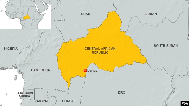
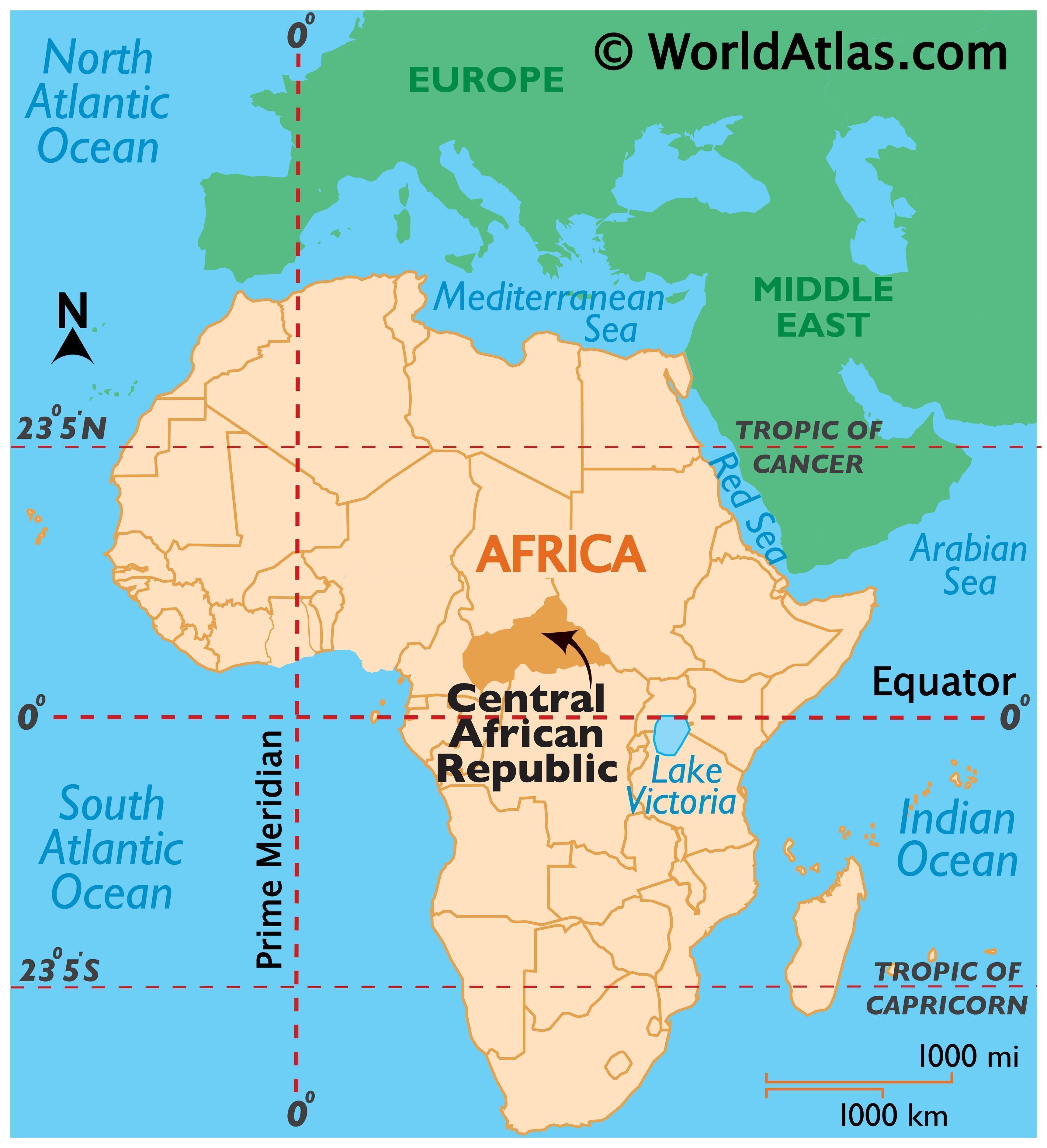
The Central African Republic is a landlocked nation within
the interior of the African continent. It is bordered by Cameroon, Chad, Sudan,
South Sudan, the Democratic Republic of the Congo, and the Republic of the
Congo. The country lies between latitudes 2° and 11°N, and longitudes 14° and
28°E.
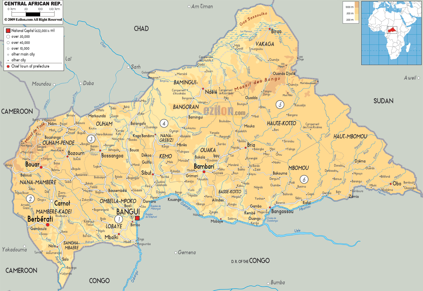
Much of the country consists of flat or rolling plateau
savanna approximately 500 metres (1,640 ft) above sea level. Most of the
northern half lies within the World Wildlife Fund's East Sudanian savanna
ecoregion. In addition to the Fertit Hills in the northeast of the CAR, there
are scattered hills in the southwest regions. In the northwest is the Yade
Massif, a granite plateau with an altitude of 348 metres (1,143 ft).
Central African Republic Map - Central African Republic
At 622,941 square kilometres (240,519 sq mi), the Central African Republic is the world's 45th-largest country. It is comparable in size to Ukraine.
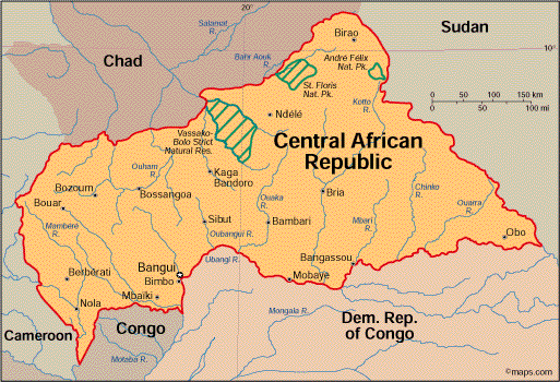
Much of the southern border is formed by tributaries of the Congo River; the Mbomou River in the east merges with the Uele River to form the Ubangi River, which also comprises portions of the southern border. The Sangha River flows through some of the western regions of the country, while the eastern border lies along the edge of the Nile River watershed.
Map of Central African Republic
It has been estimated that up to 8% of the country is covered by forest, with the densest parts generally located in the southern regions. The forests are highly diverse and include commercially important species of Ayous, Sapelli and Sipo.[45] The deforestation rate is about 0.4% per annum, and lumber poaching is commonplace.[46]
In 2008, Central African Republic was the world's least light pollution affected country.[47]
The Central African Republic is the focal point of the Bangui Magnetic Anomaly, one of the largest magnetic anomalies on Earth.[48]
map_of_central-african- ...

According to the 2003 national census, 80.3% of the
population is Christian—51.4% Protestant and 28.9% Roman Catholic—and 15% is
Muslim.[54] Indigenous belief (animism) is also practiced, and many indigenous
beliefs are incorporated into Christian and Islamic practice.[55] A UN director
described religious tensions between Muslims and Christians as being high.[56]
The CIA World Factbook reports that approximately fifty
percent of the population of CAR are Christians (Protestant 25%, Roman Catholic
25%), while 35% of the population maintain indigenous beliefs and 15% practice
Islam,[7] though it is unclear how recent this information is.[citation needed]
Central African Republic Clashes
There are many missionary groups operating in the country, including Lutherans, Baptists, Catholics, Grace Brethren, and Jehovah's Witnesses. While these missionaries are predominantly from the United States, France, Italy, and Spain, many are also from Nigeria, the Democratic Republic of the Congo, and other African countries. Large numbers of missionaries left the country when fighting broke out between rebel and government forces in 2002–3, but many of them have now returned to continue their work.[57]
According to Overseas Development Institute research, during the crisis ongoing since 2012, religious leaders have mediated between communities and armed groups; they also provided refuge for people seeking shelter.[58]
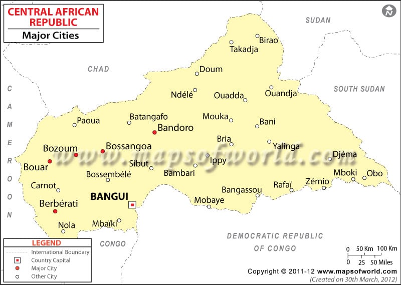
Central African Republic Cities Map, Major Cities in Central
The currency of Central African Republic is the CFA franc,
which is accepted across the former countries of French West Africa and trades
at a fixed rate to the Euro. Diamonds constitute the country's most important
export, accounting for 40–55% of export revenues, but it is estimated that
between 30% and 50% of those produced each year leave the country
clandestinely.
Graphical depiction of Central African Republic's product
exports in 28 color-coded categories
Agriculture is dominated by the cultivation and sale of food
crops such as cassava, peanuts, maize, sorghum, millet, sesame, and plantain.
The annual real GDP growth rate is just above 3%. The importance of food crops
over exported cash crops is indicated by the fact that the total production of
cassava, the staple food of most Central Africans, ranges between 200,000 and
300,000 tonnes a year, while the production of cotton, the principal exported
cash crop, ranges from 25,000 to 45,000 tonnes a year. Food crops are not
exported in large quantities, but still constitute the principal cash crops of
the country, because Central Africans derive far more income from the periodic
sale of surplus food crops than from exported cash crops such as cotton or
coffee.[citation needed] Much of the country is self-sufficient in food crops;
however, livestock development is hindered by the presence of the tsetse
fly.[citation needed]
Central African Republic Map - Travel Africa Tourist Guide

The Republic's primary import partner is the Netherlands (19.5%). Other imports come from Cameroon (9.7%), France (9.3%), and South Korea (8.7%). Its largest export partner is Belgium (31.5%), followed by China (27.7%), the Democratic Republic of Congo (8.6%), Indonesia (5.2%), and France (4.5%).[7]
The per capita income of the Republic is often listed as being approximately $400 a year, one of the lowest in the world, but this figure is based mostly on reported sales of exports and largely ignores the unregistered sale of foods, locally produced alcoholic beverages, diamonds, ivory, bushmeat, and traditional medicine. For most Central Africans, the informal economy of the CAR is more important than the formal economy.[citation needed]
Atlas: Central African Republic
Export trade is hindered by poor economic development and the country's landlocked position.[citation needed]
The CAR is a member of the Organization for the Harmonization of Business Law in Africa (OHADA). In the 2009 World Bank Group's report Doing Business, it was ranked 183rd of 183 as regards 'ease of doing business', a composite index which takes into account regulations that enhance business activity and those that restrict it.[75]
Central African Republic: Central African Republic political

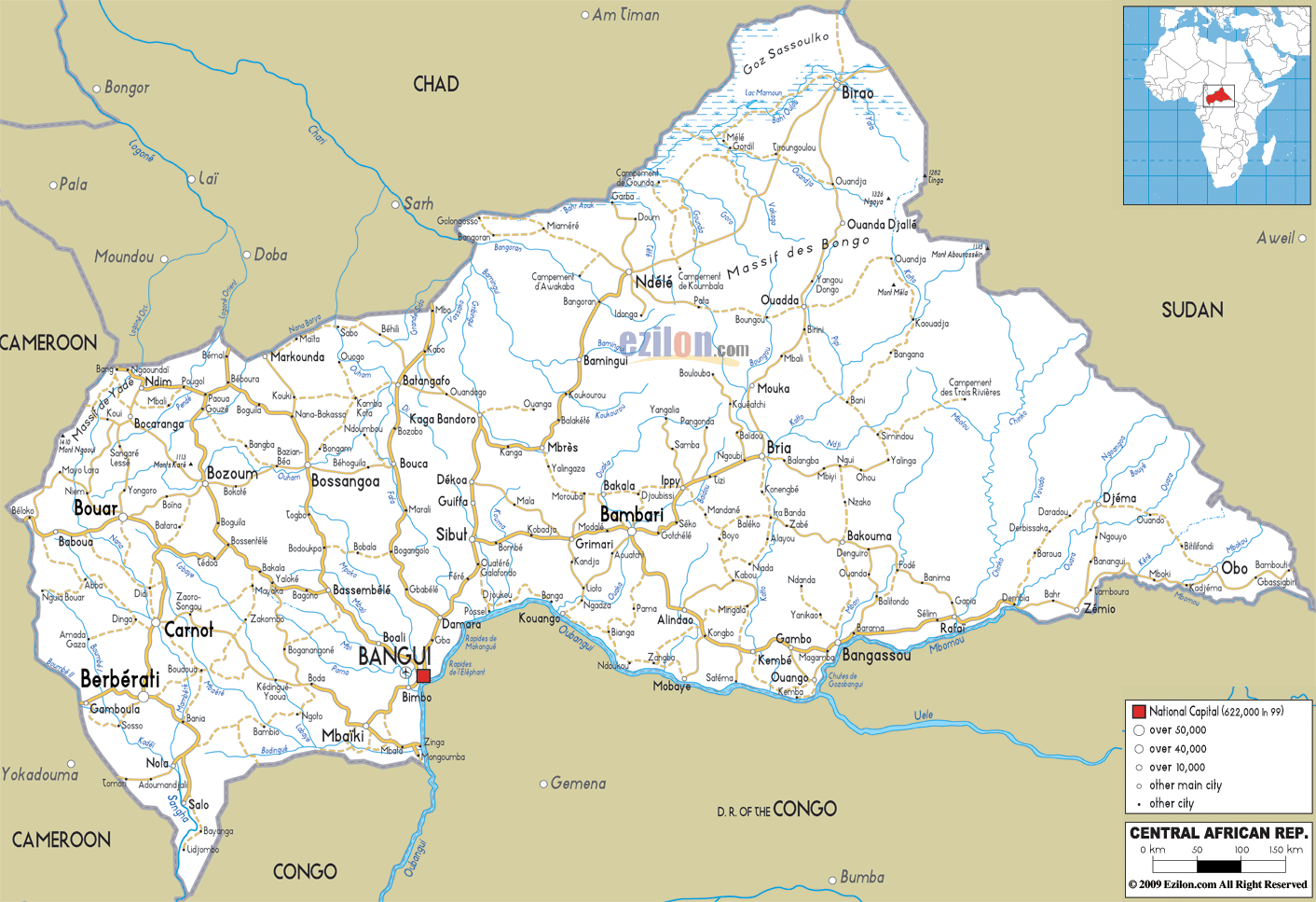
Bangui is the transport hub of the Central African Republic.
As of 1999, eight roads connected the city to other main towns in the country,
Cameroon, Chad and South Sudan; of these, only the toll roads are paved. During
the rainy season from July to October, some roads are impassable.[76][77]
River ferries sail from the river port at Bangui to
Brazzaville and Zongo. The river can be navigated most of the year between
Bangui and Brazzaville. From Brazzaville, goods are transported by rail to
Pointe-Noire, Congo's Atlantic port.[78] The river port handles the
overwhelming majority of the country's international trade and has a cargo
handling capacity of 350,000 tons; it has 350 metres (1,150 ft) length of
wharfs and 24,000 square metres (260,000 sq ft) of warehousing space.[76]
Bangui M'Poko International Airport is Central African
Republic's only international airport. As of June 2014 it had regularly
scheduled direct flights to Brazzaville, Casablanca, Cotonou, Douala,
Kinshasha, Lomé, Luanda, Malabo, N'Djamena, Paris, Pointe-Noire, and Yaoundé.
Since at least 2002 there have been plans to connect Bangui
by rail to the Transcameroon Railway.[79]
Central African Republic Map / Geography of Central African
The 2009 Human Rights Report by the United States Department
of State noted that human rights in CAR were poor and expressed concerns over
numerous government abuses.[90] The U.S. State Department alleged that major
human rights abuses such as extrajudicial executions by security forces,
torture, beatings and rape of suspects and prisoners occurred with impunity. It
also alleged harsh and life-threatening conditions in prisons and detention
centers, arbitrary arrest, prolonged pretrial detention and denial of a fair
trial, restrictions on freedom of movement, official corruption, and restrictions
on workers' rights.[90]
Central African Republic
The State Department report also cites widespread mob violence, the prevalence of female genital mutilation, discrimination against women and Pygmies, human trafficking, forced labor, and child labor.[91] Freedom of movement is limited in the northern part of the country "because of actions by state security forces, armed bandits, and other nonstate armed entities", and due to fighting between government and anti-government forces, many persons have been internally displaced.[92]
Violence against children and women in relation to accusations of witchcraft has also been cited as a serious problem in the country.[93][94][95] Witchcraft is a criminal offense under the penal code.[93]
Central African Republic Maps
Freedom of speech is addressed in the country's constitution, but there have been incidents of government intimidation of the media.[90] A report by the International Research & Exchanges Board's media sustainability index noted that "the country minimally met objectives, with segments of the legal system and government opposed to a free media system".[90]
Approximately 68% of girls are married before they turn 18,[96] and the United Nations' Human Development Index ranked the country 179 out of 187 countries surveyed.[97] The Bureau of International Labor Affairs has also mentioned it in its last edition of the List of Goods Produced by Child Labor or Forced Labor.
File:Central African Republic location map

Hiç yorum yok:
Yorum Gönder